 Transportul electric urban
Maps • Netzpläne
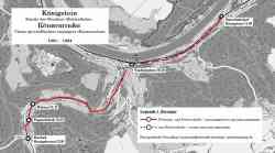
Königstein
 |
Königstein 16 februarie 1902 an |
Pictures displayed: 1 out of 1
Photos currently sorted by date (New photos listed first).
Dark Theme
© Administratorii al Transphoto și autore/i materialelor, 2002—2025
Utilizarea fotografiilor sau a altor materialele de pe acest site-ul fără acordul autorului este interzisa.
Utilizarea fotografiilor sau a altor materialele de pe acest site-ul fără acordul autorului este interzisa.


